The project is to be released as a pre-alpha (concept proof) state and in order to test the the main functionality. Anyone interested in helping me to test and optimize it please contact me.
Also, I am working to add translation in twenty different languages to start with, so if you are willing to help on this please let me know.
I am looking for sponsorship to support this free software. That will go to host this project on its own site (capable to handle a large world wide collaboration database) and also to develop a wide spectrum of aditional features. For further details on how you can help please contact me.
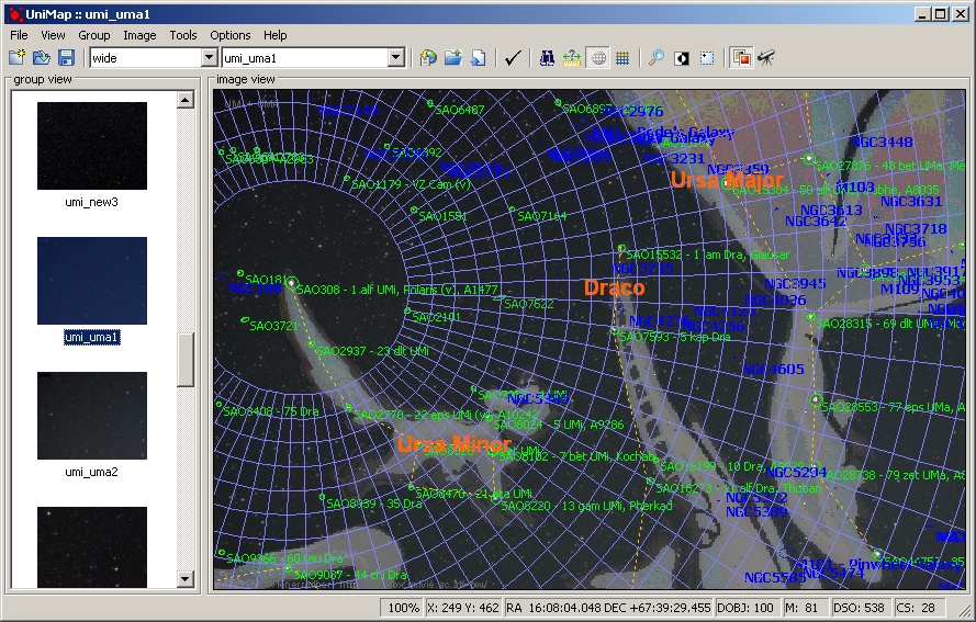
Ursa Minor detection with grid and constellation artwork
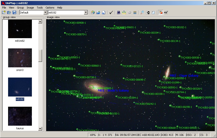
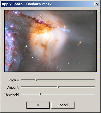
M81/M82 - Bode's galaxy and Cigar galaxy plate-solving
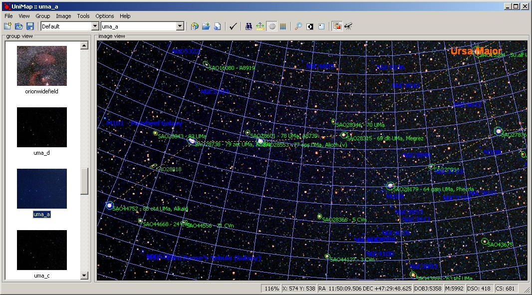
Ursa Major detection with grid and constellation lines
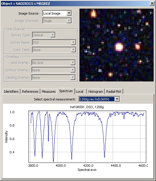
Star/Object details screen - Spectrum Tab
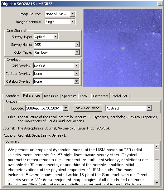
Star/Object details screen - NASA skyview/DSS image and References tab
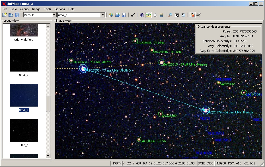
Astronomical distances measurement tool - Alioth to Phecda in Ursa Major
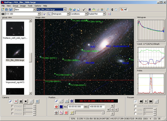
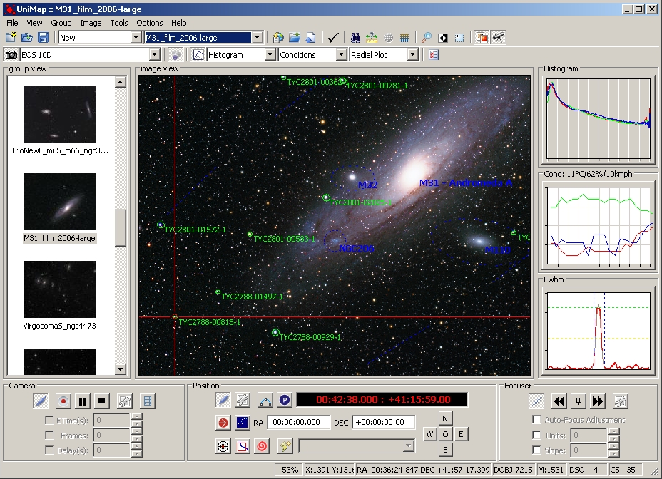
Integrated telescope and camera control overview - M31 - Adromeda galaxy
Integrated telescope and camera control - tracking a star in M27 with digital camera.
Integrated telescope and camera control - tracking a laser pointer on the wall with a webcam.
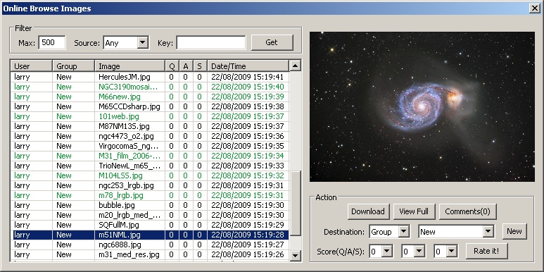
Unimap online image browse/download/rate
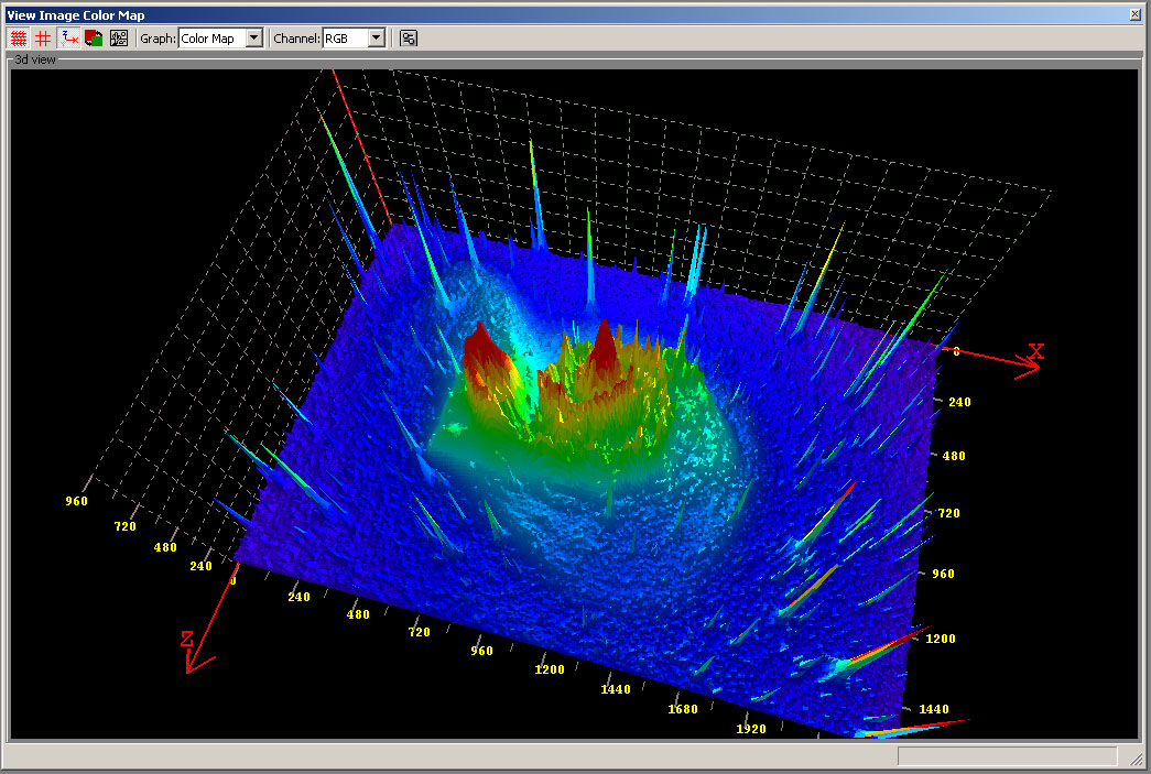
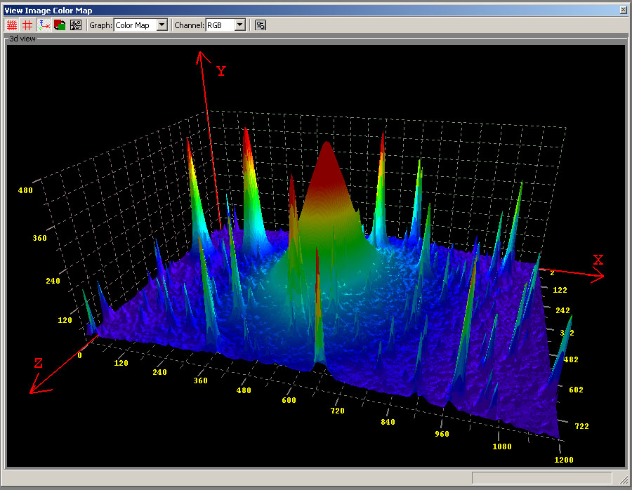
3d Image Color Plot - OpenGL
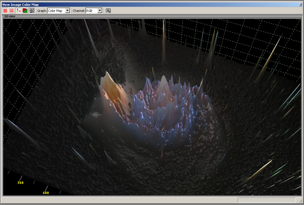
3d Image Color Plot with Photo map
3d Image Color Plot
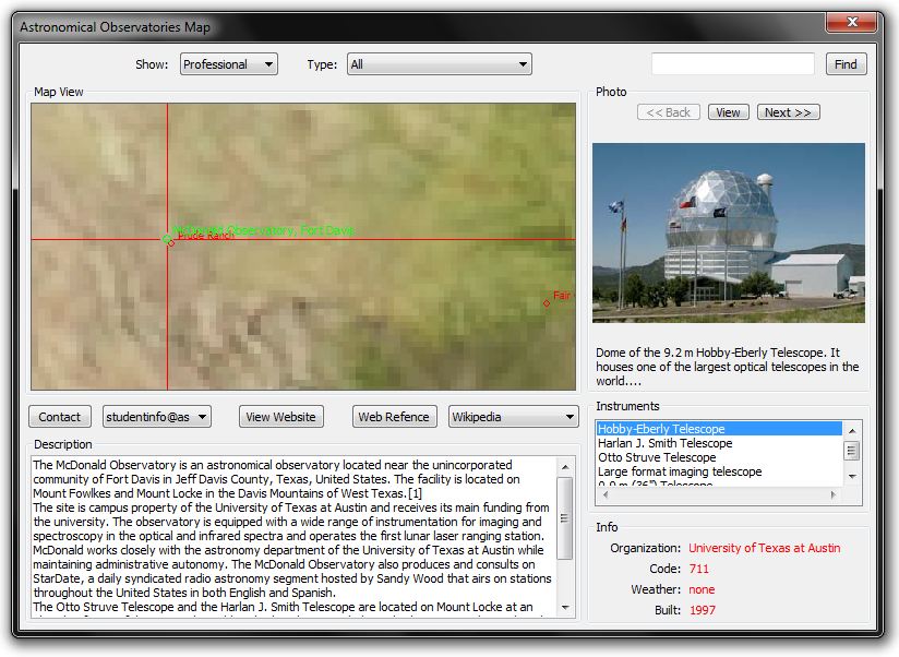
World Wide Observatories Interactive map
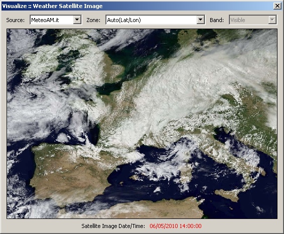
Current weather satellite view
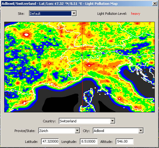
Interactive world wide Light Pollution map
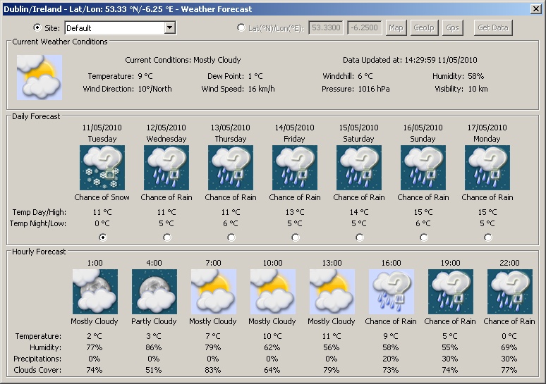
Weather Forecast Screen
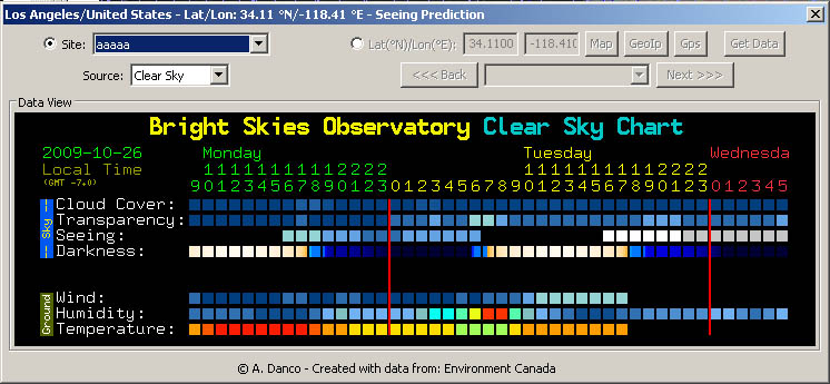
Seeing prediction - 48h - for North America with ClearSky
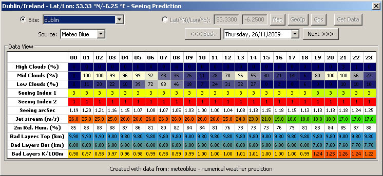
Seeing prediction - 7 days - for Europe with Meteo Blue
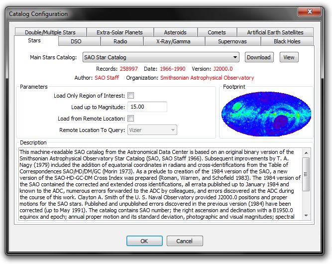
Catalog Selection - Stars Tab
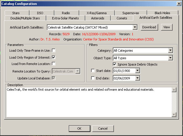
Catalog Selection - Earth Artificial Satellites Tab
Sample Filter Screen
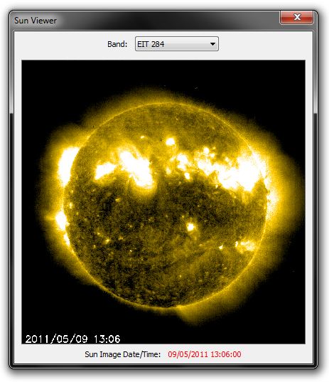
Sun View - Latest solar activity